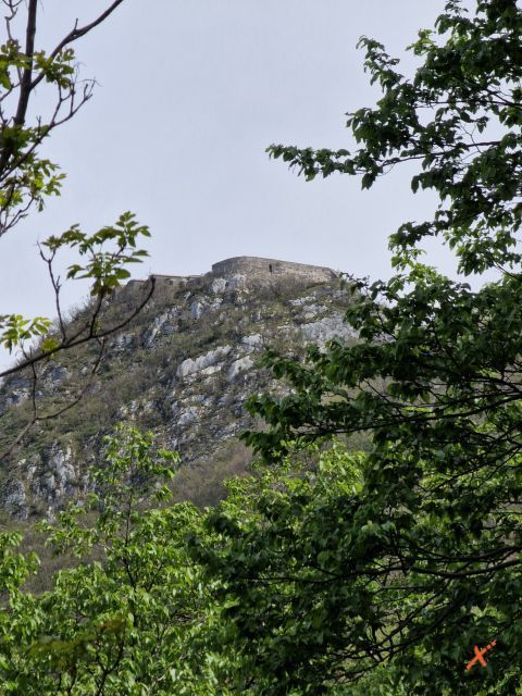
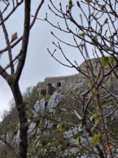
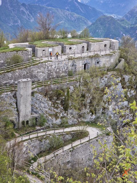
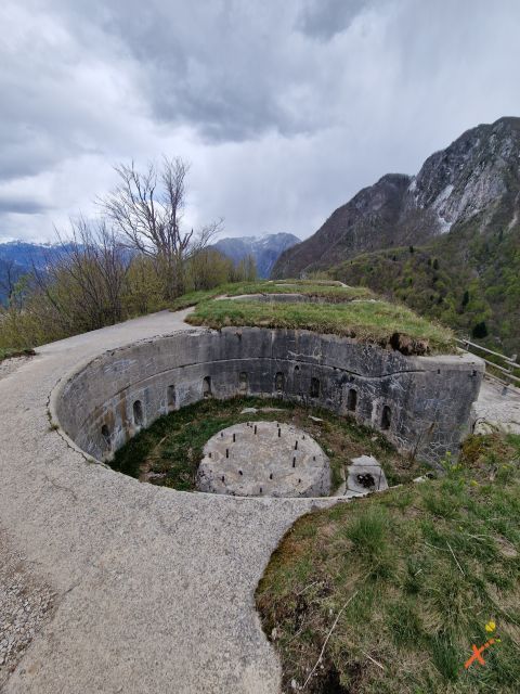
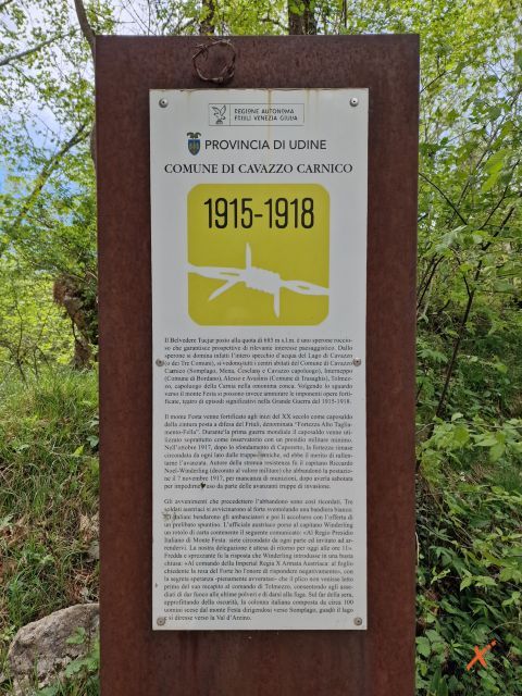
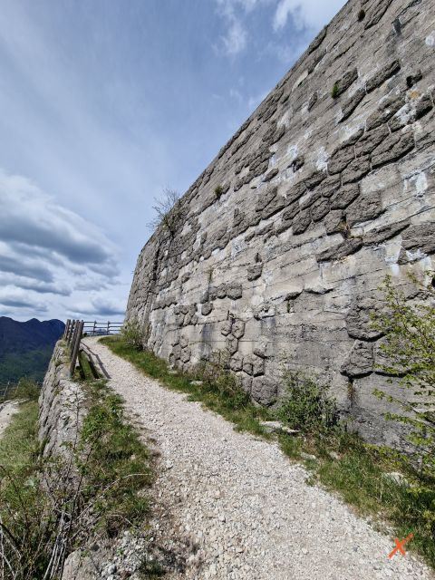
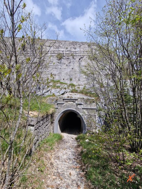
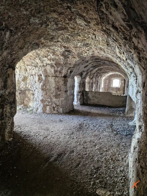

Mount Festa is scenically stunning, with a unique panorama, and is also an evocative place of commemorative value because it was part of a historic defense system, that of the “Alto Tagliamento – Val Fella,” which was the scene of important wartime events. The military work it houses is incomparable in that it exploits the natural features of the mountain for defensive purposes. The hike to Mount Festa is special for this reason: it offers natural environments and extraordinary views, along with a cultural experience that leads to the discovery of World War I trails.
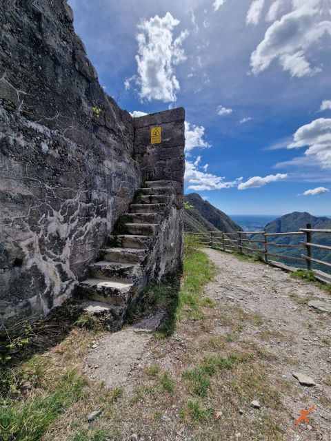
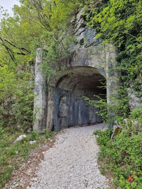
A fortified mountain is an extraordinary place. The ascent through the tunnels, the fort’s location at the top of the mountain, and the natural surroundings make this hike unique.
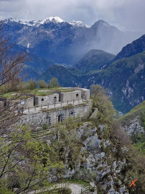
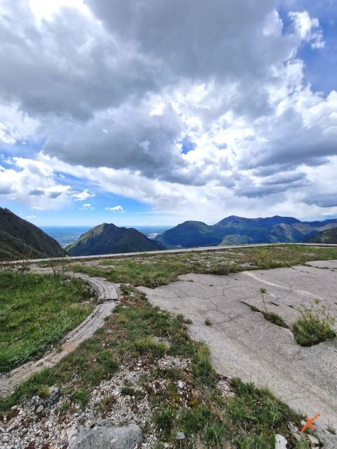
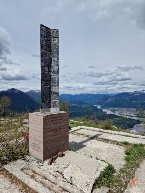
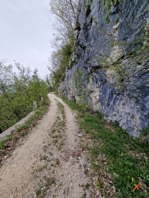
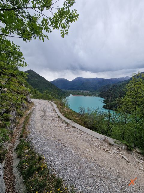
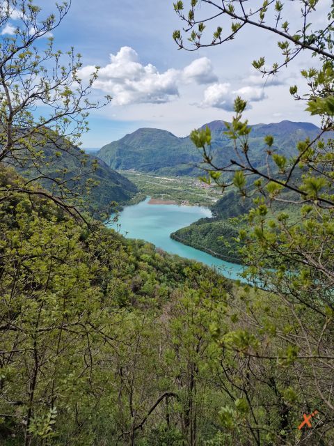
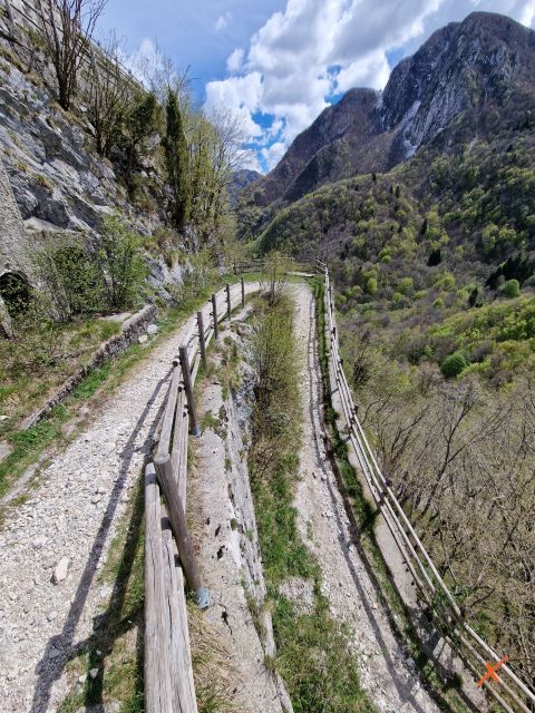
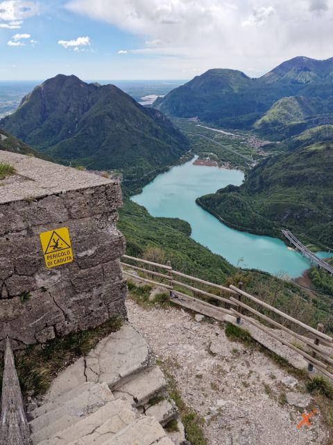
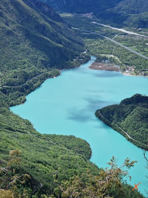
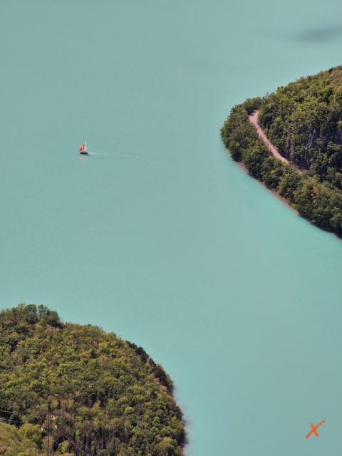
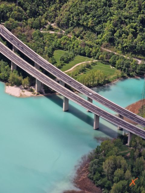
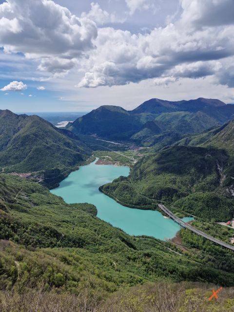
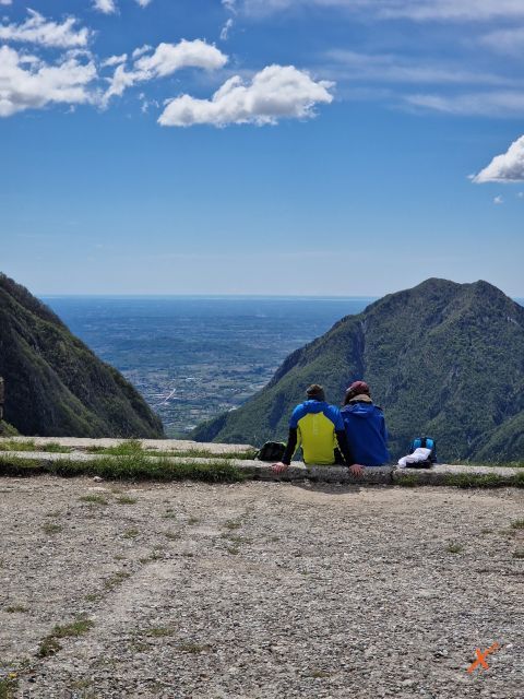
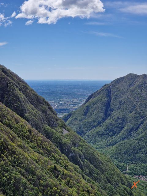
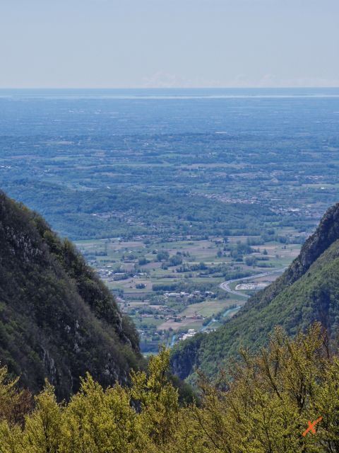
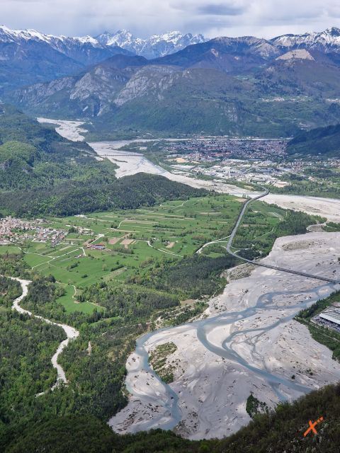
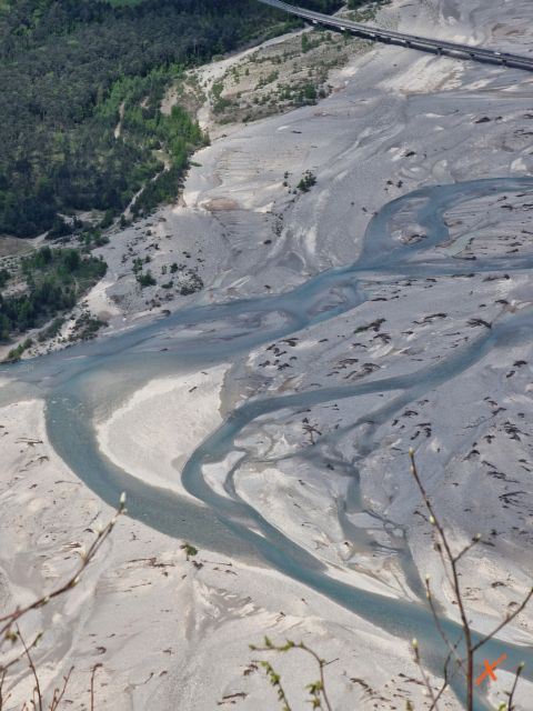
Already along the way this hike offers beautiful views of Lake Cavazzo, the Friulian plain, the Tagliamento River and the surrounding mountains. Upon arrival, from the fort at the top of the mountain, the view is breathtaking.
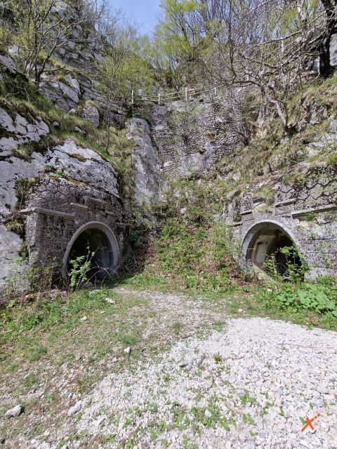
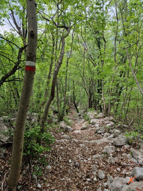
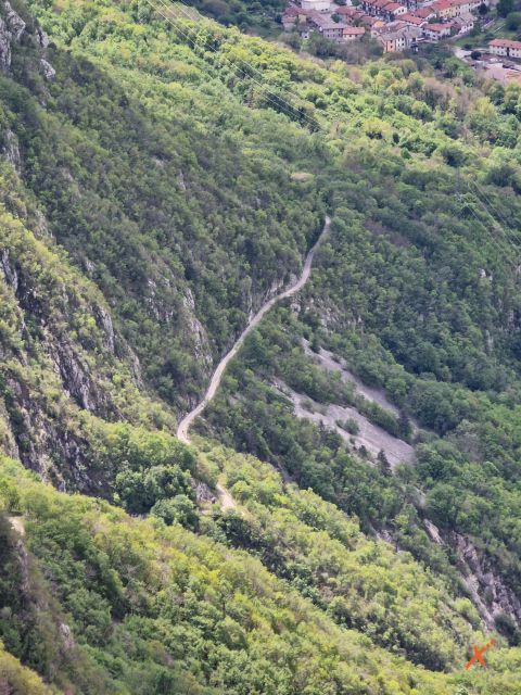
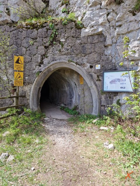
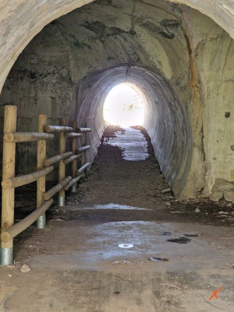
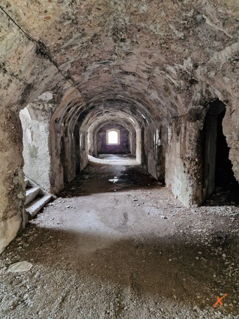
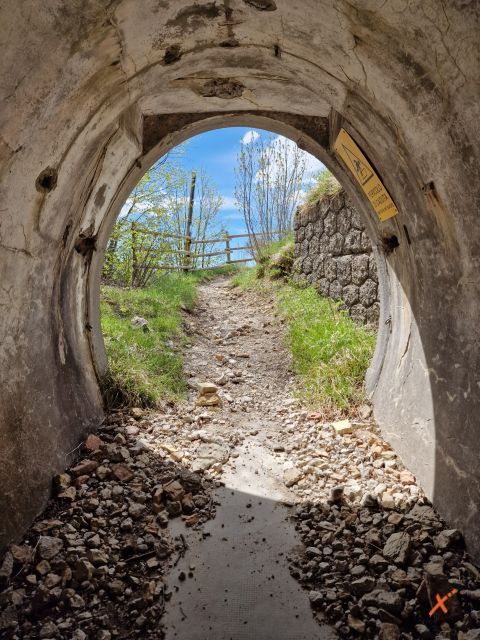
A day on Mount Festa gives a mix of history and nature. The approach is pleasant and interesting in the midst of nature; having passed the first half of the route, the first barracks are encountered and then we arrive at the countless tunnels and the fort.
The Fort on Mount Festa can be reached by 2 routes: the military road and CAI trail 838. The two paths intersect at several points, and it is possible to switch from trail to mule track and vice versa. In addition to making the route more varied, these intersection points are useful in view of the fact that by exclusively following the military road, the length would increase by 4 km.
From the parking lot take the military road to Monte Festa, continue for about 3 km before meeting CAI trail 838 at 3 stone steps. From here choose according to the characteristics of the routes:
The CAI trail is hiking type (E) and is 9 km long, with 700 m elevation gain. The cart road is 13 km long, with equal elevation gain. Given these elements, the hike is suitable for people who are used to walking in the mountains and have appropriate footwear and clothing. People are also reminded to bring water and a flashlight for visiting the tunnels.
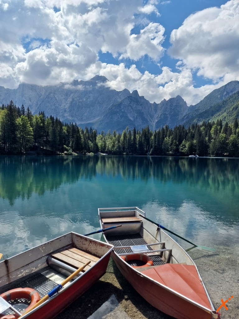
After a long climb via the military road or the path through the hornbeam and ash forest, the arrival at the top of the mountain reserves a breathtaking natural spectacle. From the fort on the summit, the view is extraordinary and encompasses the entire valley and surrounding peaks. The view also sweeps over the loops of the Tagliamento River and Lake Cavazzo, or Lake of the Three Municipalities, Friuli Venezia Giulia’s largest lake at 2250 meters in length.
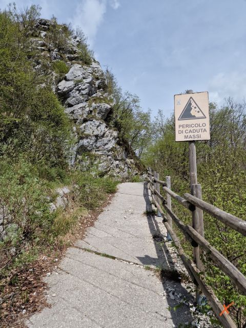
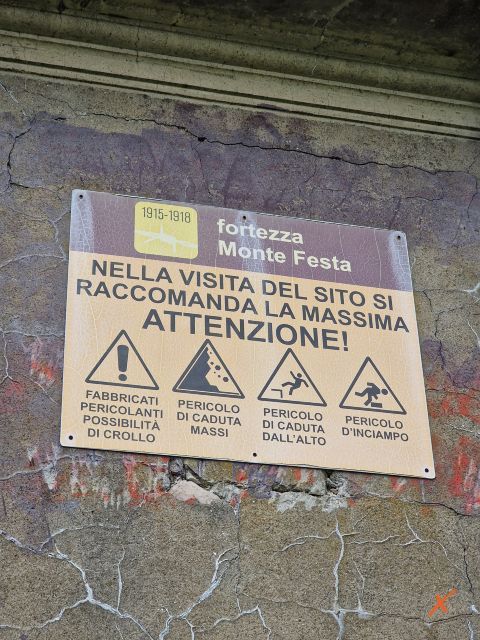
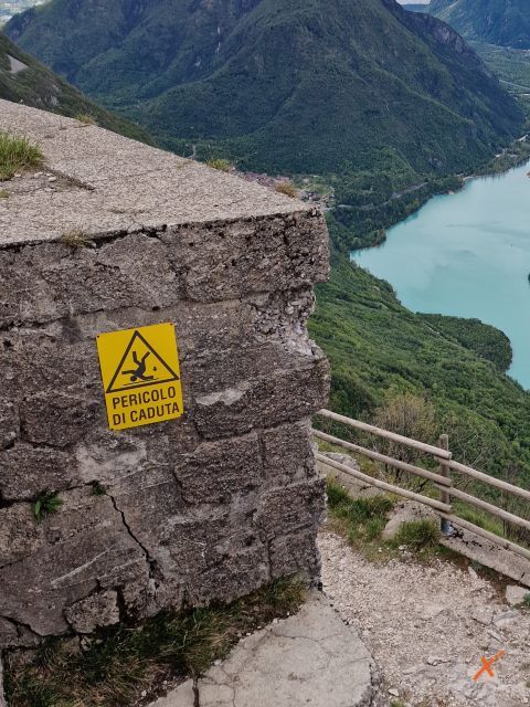
The hike to the fort is to be considered challenging, due to length and elevation gain, so it requires physical preparation and appropriate clothing. Great care must also be taken when visiting the ruins of military buildings because of the state of the structures and floors, which date back to the early 1900s. It is most important to observe all posted signs and respect barriers and prohibitions. It is also recommended to carry a flashlight to explore the tunnels.
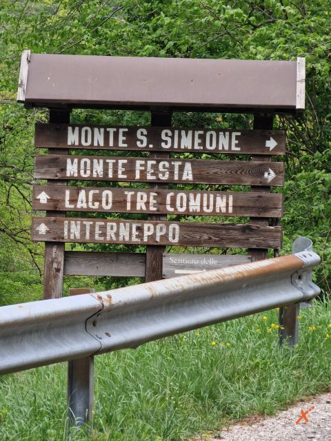
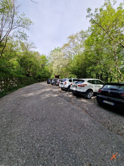
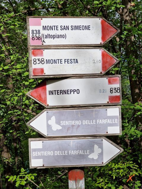
Mount Festa Fort is located in the municipality of Cavazzo Carnico above the village of Interneppo. Coming from Bordano or Interneppo take the road in the direction of Monte Festa/Monte San Simeone. Continue to the junction to Mount Festa, at a no-trespassing sign and the beginning of the “Butterfly Trail” there is a small parking lot. In case there are no vacancies, turn back to the wooden sign with directions to “Monte Festa” and “Monte San Simeone” and leave the car at the side of the road.
The length depends on the route chosen. The military road is 13 km long, but by taking CAI path 838, well marked at 3 stone steps, you save 4 km. The path, however, is less linear and a bit more strenuous to walk.
Neither the mule track nor the trail has support points. At an altitude of 800 meters a fountain is encountered, but there is no certainty of finding it open and it is still essential to bring a good supply of water.
Yes, via the former military road. The route is 13 km with 700 m of elevation gain.
Experiences in Friuli Venezia Giulia
Advertisement
The contents of this page are protected from reproduction and copying with a digital certificate